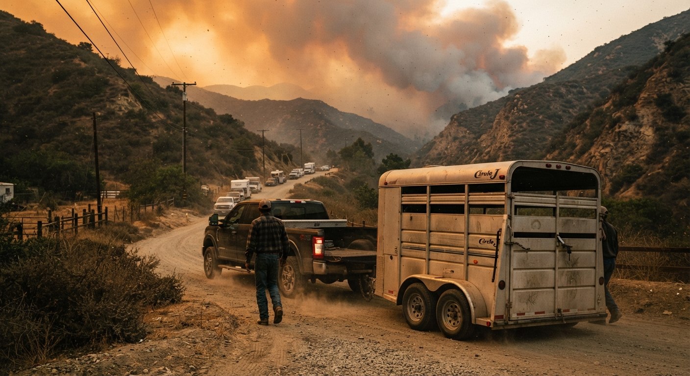
Los Angeles County faces substantial, ongoing wildfire risk, particularly across its wildland-urban interface, foothill, canyon, and mountain communities. CAL FIRE/OSFM Fire Hazard Severity Zone maps identify extensive high and very high wildfire hazard areas throughout the county. FEMA's National Risk Index separately evaluates county-level risk across 18 natural hazards — including wildfire — using expected annual loss, social vulnerability, and community resilience; it's a useful multi-hazard reference point, not a wildfire-specific ranking on its own. For horse owners specifically, that risk carries a dimension that most wildfire guidance never addresses: a 1,200-pound animal cannot be picked up and carried to safety in thirty seconds the way a cat or a photo album can.
This guide exists because of a real, specific gap. Search coverage of past LA County fires is extensive, but almost entirely reactive — news reports written after a barn was already burning. What's harder to find is a calm, organized, LA-County-specific resource written before an emergency, when there's still time to build a real plan. That's what this piece is for.
This is general preparedness information, not a substitute for official guidance. Evacuation zones, shelter capacity, and road conditions change in real time during an actual event — always verify current status directly through the official sources linked throughout this guide rather than relying on anything here once a fire is actually active.
Table of Contents
- Why This Matters: The Real Record
- Sign Up for Alerts Before You Need Them
- The Single Most Important Piece of Advice: Evacuate Early
- If You Truly Cannot Evacuate: Do Not Turn Your Horses Loose
- Building Your Evacuation Plan
- Where Horses Have Been Evacuated in LA County — and Why the List Changes
- City vs. County: Know Which Applies to You
- When Local Terrain Limits Official Help
- Your Emergency Kit
- A Note on Defensible Space
- Official Resources to Bookmark Now
Why This Matters: The Real Record
This isn't an abstract risk. In December 2017, the Creek Fire tore through Rancho Padilla near Sylmar — one of this site's own neighborhoods — in the middle of the night. More than 60 horses were stabled there; at least 29 died in the fire, while others survived and were rescued. In 2019, the Getty Fire sent more than 150 horses to Hansen Dam Equestrian Center for shelter, according to LA Animal Services' own account of the response. In January 2025, the Eaton and Palisades fires burned 37,469 acres combined (14,021 and 23,448 acres respectively, per LA County's own official record). Over the following 11 days, LA County's Department of Animal Care and Control received 460 animals into emergency sheltering, including 205 horses, according to a firsthand account published by DACC Director Marcia Mayeda — even as the department's own Equine Response Team confirmed some horses were lost in the fires.
No amount of preparation guarantees an outcome — wind-driven fires can overwhelm even well-prepared communities. But the pattern across these accounts is consistent: horses owners who had already practiced loading, already knew where they were going, and left early were far better positioned than those who waited. Preparation doesn't eliminate the risk; it materially improves the odds.
Sign Up for Alerts Before You Need Them
The earliest possible warning is the single highest-leverage thing you can do, and it costs nothing. LA County actually runs several overlapping alert systems, and which ones apply to you depends on exactly where your property sits.
Alert LA County is the county's own opt-in system, delivering alerts by text, email, or phone call, with accessibility features for people with disabilities. This is the one to register for if your property is in an unincorporated area.
NotifyLA is a separate system specific to the City of Los Angeles — not the county. If your property sits within LA city limits, this is the one you actually need; Alert LA County alone won't cover you.
Wireless Emergency Alerts (WEA) come automatically to your cell phone based on your physical location, no sign-up required, but confirm the setting is actually enabled (on iPhone: Settings → Notifications → Government Alerts; on Android, look under Settings → Apps → Emergency Alerts). It's worth knowing WEA is a safety net, not your primary source — it typically activates only once an evacuation order has already been issued, while the county and city systems above can sometimes deliver warnings earlier.
Watch Duty, a free app, became one of the most relied-upon real-time tools during the January 2025 fires, tracking active incidents with a level of detail official channels don't always match in the first chaotic hours.
To check your specific property's current evacuation status at any time, LA County's tool is protect.genasys.com.
If your property is in a canyon or has historically poor cell coverage, a NOAA weather radio using S.A.M.E. (Specific Area Message Encoding) technology can deliver alerts even when phone service fails.
The Single Most Important Piece of Advice: Evacuate Early
Every official source on this topic converges on the same core message: leave before you're ordered to, not after. A horse trailer takes real time to load, especially with an anxious or untrained animal, and Santa Ana wind-driven fires can move faster than that loading process. LA County's own Animal Care and Control materials put it in exactly two words: evacuate early.
For horse owners specifically, a Red Flag Warning is best treated as a signal to be fully prepared to leave at a moment's notice, while an Evacuation Warning — a step before a mandatory Evacuation Order — is the point to actually begin moving your horses. By the time a mandatory order is issued for your specific area, road conditions and available shelter space may already have changed.
If You Truly Cannot Evacuate: Do Not Turn Your Horses Loose
This is genuinely counterintuitive, and worth stating plainly because the instinct runs the opposite way. LA County Animal Care and Control's own guidance states that horses are generally safer left in their corrals than released to run loose during a wildfire — a lesson drawn directly from the 1993 Old Topanga Fire. A panicked horse running loose in smoke and wind-driven embers faces real dangers a corralled horse, in a cleared area away from structures, often doesn't.
This is not a substitute for evacuating when you can. It's specifically about the scenario where evacuation is no longer possible and a decision has to be made in the moments you have left.
Building Your Evacuation Plan
A real plan, built before fire season, includes:
- Practice loading and unloading your horse regularly — not just once. A horse that loads calmly on a quiet Tuesday afternoon may refuse entirely with smoke in the air and sirens in the distance. This is the single most commonly cited failure point in real evacuation accounts.
- Keep your truck and trailer fueled and road-ready at all times, and treat Red Flag Warning days as a specific trigger to top off the tank, since gas stations along evacuation routes can become gridlocked or lose power during a real event.
- Pre-arrange a destination before you need one — a friend's property outside the fire-risk area, a boarding facility willing to take emergency arrivals, or family with suitable space. Don't assume an official shelter will have room; as the next section covers, that's not a safe assumption.
- Exchange contact information with neighbors, especially anyone who might evacuate your horse for you if you're not home when an order comes. Give them your contact information, your horse's identification and veterinary records, and any access instructions they'd need — kept in your emergency kit and somewhere digital, rather than exchanging sensitive personal documents casually in advance.
- Know more than one route out. Fire can close the road you'd planned to use.
Where Horses Have Been Evacuated in LA County — and Why the List Changes
Historically, large-animal evacuation sites used during LA County fires have included the Los Angeles Equestrian Center, Hansen Dam Equestrian Center, the Pierce College Equine Center, Industry Hills Equestrian Center, the Pomona Fairgrounds, and LA County's own Department of Animal Care and Control facilities in Agoura Hills, Castaic, and Lancaster.
Here's the important part: this list is not fixed, and treating it as a guaranteed destination is a real mistake. During the actual January 2025 fires, LA County's own official emergency page reported in real time that Pierce College and Hansen Dam had reached capacity and could no longer accept horses — while the Los Angeles Equestrian Center and Industry Hills remained open. This is a documented fact from an actual event, not a hypothetical caution.
The practical takeaway: don't drive toward a specific site assuming it will take you. Check www.animalcare.lacounty.gov for current status before you leave, if you have time to do so, and always have a pre-arranged backup that doesn't depend on an official shelter having space.
LA County's Department of Animal Care and Control also runs a dedicated Equine Response Team (ERT) — specially trained volunteers who provide emergency evacuation and temporary sheltering assistance for horses and livestock. You can reach them directly at ERT@animalcare.lacounty.gov.
City vs. County: Know Which Applies to You
This distinction matters in exactly the way jurisdiction has mattered throughout this site's zoning coverage. LA Animal Services — the City of Los Angeles's department, separate from the County's DACC — states plainly that it can only provide equine evacuation sheltering within areas the LA Fire Department has identified as mandatory evacuation zones. Outside of that, the department is explicit: you, as the owner, are responsible for arranging alternative stabling in advance.
If your property is in unincorporated LA County rather than the City of Los Angeles, your primary point of contact is the County's DACC and its Equine Response Team, not LA Animal Services. Knowing which jurisdiction actually governs your specific property — the same first step as our general LA equestrian parcel due-diligence guide — matters here too, not just for zoning questions.
When Local Terrain Limits Official Help
Some communities face a harder truth: official rescue assistance may not be available to them at all, regardless of jurisdiction. Rolling Hills' own emergency preparedness materials state directly that LA County's Equine Response Team will not perform rescues there, specifically because of the area's narrow, dead-end roads.
If you keep horses in a canyon community, a gated development, or anywhere with limited road access, don't assume county-wide services apply uniformly to your specific street. Ask directly — your local homeowners association, city equestrian committee, or the DACC itself can tell you whether your area has this kind of limitation. This is exactly the sort of hyper-local detail worth confirming once, in advance, rather than discovering during an actual evacuation.
Your Emergency Kit
Multiple official sources — LA County DACC, LA Animal Services, and city-level guidance from communities like Rolling Hills Estates — converge on a consistent list:
- A leather halter and lead rope kept near the corral at all times — leather rather than nylon, since nylon can melt in extreme heat.
- Current photos of each horse, including markings, alongside their name, age, breed, sex, vaccination status, and your own and your veterinarian's contact information.
- A three-day emergency water supply, stored in drums or barrels.
- Hay stored outside the barn, in a dry, covered area — not inside a structure that could trap or fuel a fire.
- Fire extinguishers mounted near barn entrances for quick access.
- Any medications your horse takes, clearly labeled, only as prescribed by your veterinarian.
A Note on Defensible Space
Evacuation planning and defensible space work together, not separately. Our Ranch Architecture guide covers brush clearance requirements in detail — within the City of Los Angeles specifically, LAFD requires year-round vegetation management within 200 feet of structures in designated fire-hazard areas, notably stricter than the state's general 100-foot standard. Other cities and unincorporated parts of the county may apply different rules, so confirm which jurisdiction actually governs your specific parcel. Defensible space can meaningfully reduce ember exposure and improve conditions during a fire, though it's not a guarantee that any structure or enclosure will survive.
Official Resources to Bookmark Now
- Alert LA County registration
- NotifyLA registration (City of Los Angeles only)
- Check your current evacuation zone status
- LA County Animal Care and Control — Emergency Response
- Ready LA County — Horses and Large Animals
- Equine Response Team: ERT@animalcare.lacounty.gov
- LA Fire Department Alerts
This guide will be revisited and updated as conditions, programs, and official resources change. If you notice anything here that's gone out of date, we want to know — the whole point of this piece is that it stays trustworthy over time, not just accurate on the day it was published.